Chequers, Chequers yard, Dowgate hill, St John the Baptist Walbrook EC4
St John the Baptist, Walbrook pub historyindex
The John Rocques Map of London in 1756 clearly marks the Chequers Inn and also the Chequers yard which runs between Dowgate hill and Bush lane.
A listing of historical London public houses, Taverns, Inns, Beer Houses and Hotels in St John the Baptist Walbrook parish, City of London.
Residents at this address
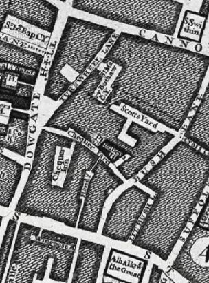
The 1682 Morgans Map of London lists 605 Chequers Inne and 606 Chequer yard
The John Rocques Map of London in 1756 clearly marks the Chequers Inn and also the Chequers yard which runs between Dowgate hill and Bush lane.